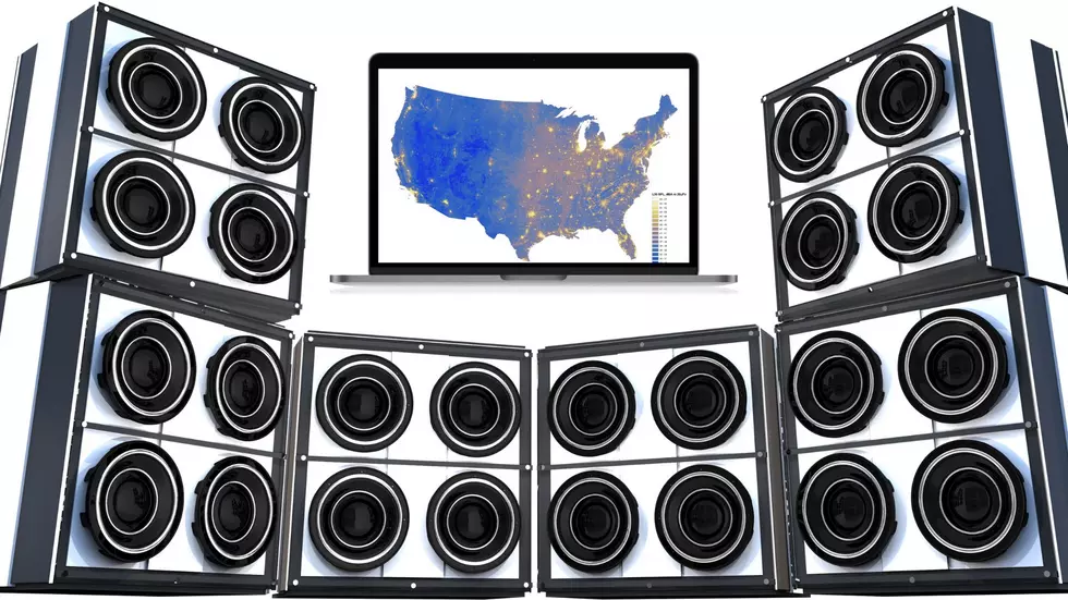
New Map Proves Missouri & Illinois are Loudest Part of America
I think of the Midwest as being peaceful. It appears science has proven me very wrong (again). According to a new map share by the government, both Missouri and Illinois are situated in the middle of the loudest part of America. Boom.

The National Park Service has a very good reason for mapping sound. They want our national parks to be relatively quite. Their research led to this interesting sound map. The bluer the map, the quieter the area. The big yellow spots? Well, that's sound and apparently we're responsible for a lot of it.
The feds even shared a helpful video explaining their view of sound and how they mapped it.
Here's the methodology they shared about how they figured out our part of America was so dang loud:
Scientists made long term measurements of sound in parks as well as urban and rural areas across the country. This information helped predict current sound levels for the entire United States. A model was developed to understand relationships between measured sound levels and variables such as climate, topography, human activity, time of day, and day of year.
So what does it all mean? The National Park Service uses this data to recommend regulations for sound in certain areas. For loud metro areas like Chicago and St. Louis, there's not much you can do. But, when it comes to the Missouri Ozarks and forest areas in southern Illinois, they hope to keep unnecessary sound from industrial sources and traffic to a minimum.
Will it work? I have my doubts, but it is an interesting view of how loud (or not) we actually are.
See Inside a Rustic Quincy Cabin with a Peaceful Pond in the Back
More From KHMO-AM 1070, News-Talk-Sports


